News Warner Logo

News Warner

NASA Studies Wind Effects and Aircraft Tracking with Joby Aircraft

NASA Studies Wind Effects and Aircraft Tracking with Joby Aircraft

  • NASA is studying wind effects and aircraft tracking with Joby Aircraft to advance air taxi flights, especially those occurring in cities.
  • The agency is collecting data from a network of ground sensors and using lidar technology to measure precise distances and map out wind features.
  • The goal of the study is to improve tools for collision avoidance and landing operations, as well as ensure safe and efficient air taxi operations in various weather conditions.
  • NASA will use the data gathered from this study to demonstrate its “distributed sensing” technology, which involves embedding multiple sensors in an area where aircraft are operating.
  • The technology has the potential to enhance collision avoidance systems, air traffic management, ground-based landing sensors, and more, benefiting companies working on air taxis and drones.

3 min read

Preparations for Next Moonwalk Simulations Underway (and Underwater)
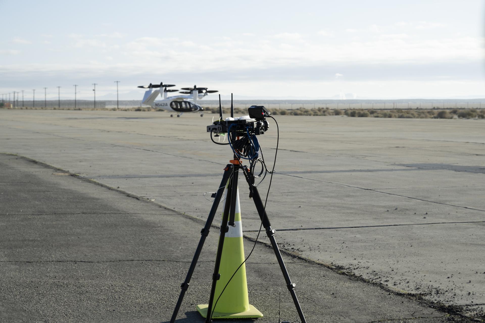
A yellow traffic cone and a black tripod with black testing instruments stands in the foreground on a concrete pad with a desert landscape, power lines, and a black and white aircraft in the background. The aircraft has six black propellors that sit on white arms and connect to the aircraft body, which has black doors and is pod-shaped. The aircraft sits on three small wheels.
One of several NASA distributed sensing ground nodes is set up in the foreground while an experimental air taxi aircraft owned by Joby Aviation sits in the background near NASA’s Armstrong Flight Research Center in Edwards, California, on March 12, 2025. NASA is collecting information during this study to help advance future air taxi flights, especially those occurring in cities, to track aircraft moving through traffic corridors and around landing zones.
NASA/Genaro Vavuris

NASA engineers began using a network of ground sensors in March to collect data from an experimental air taxi to evaluate how to safely integrate such vehicles into airspace above cities – in all kinds of weather.

Researchers will use the campaign to help improve tools to assist with collision avoidance and landing operations and ensure safe and efficient air taxi operations in various weather conditions.

For years, NASA has looked at how wind shaped by terrain, including buildings in urban areas, can affect new types of aircraft. The latest test, which is gathering data from a Joby Aviation demonstrator aircraft, looks at another kind of wind – that which is generated by the aircraft themselves.

Joby flew its air taxi demonstrator over NASA’s ground sensor array near the agency’s Armstrong Flight Research Center in Edwards, California producing air flow data. The Joby aircraft has six rotors that allow for vertical takeoffs and landings, and tilt to provide lift in flight. Researchers focused on the air pushed by the propellers, which rolls into turbulent, circular patterns of wind.
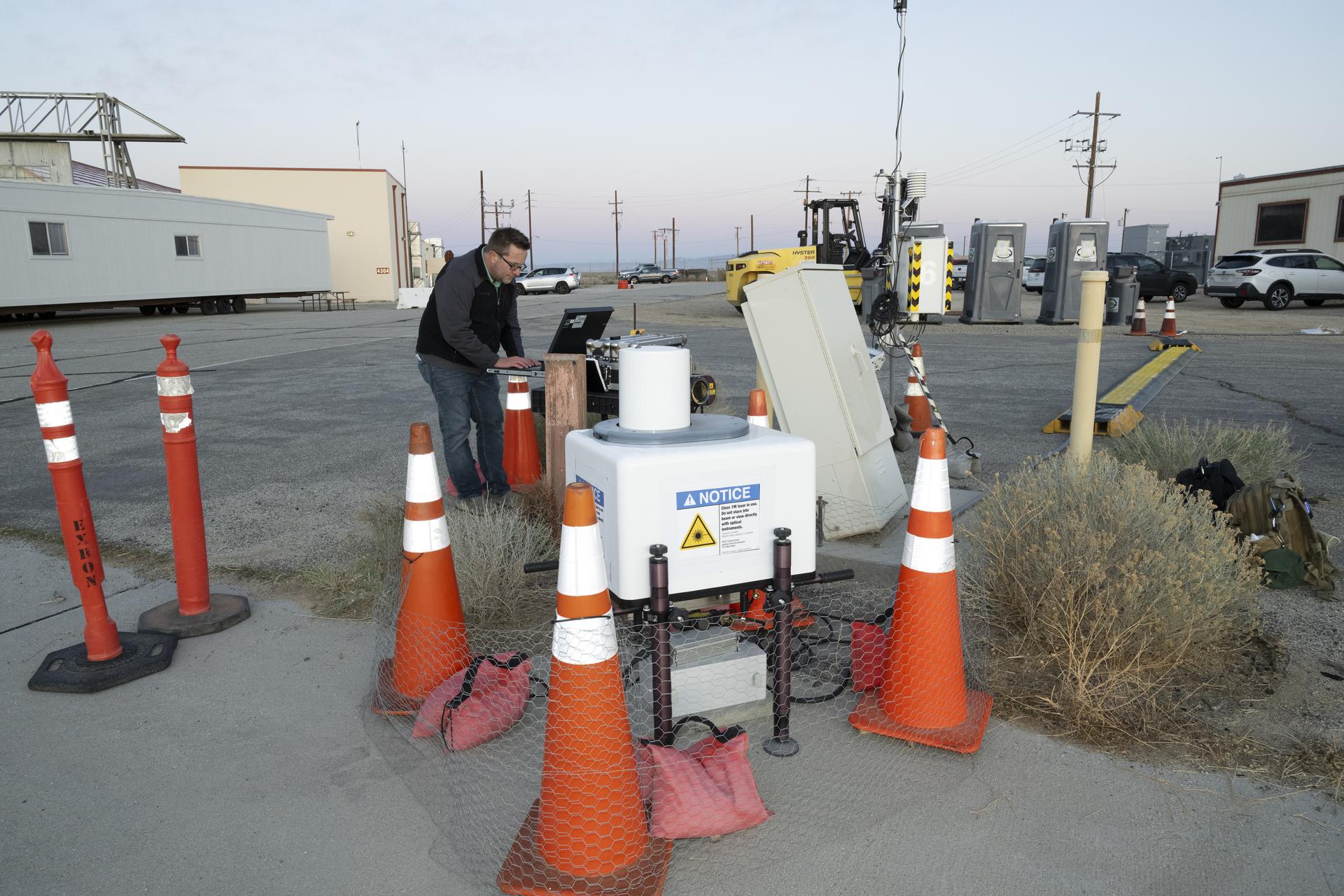
Five orange traffic cones and barriers sit in front of a large white box in the foreground. In the background, a man wearing jeans and a black sweatshirt stands in front of a black laptop. Behind him, there are several cream-colored trailers, other construction equipment, and a few cars.
NASA aeronautical meteorologist Luke Bard adjusts one of several wind lidar (light detection and ranging) sensors near NASA’s Armstrong Flight Research Center in Edwards, California, on March 12, 2025, in preparation to collect data from Joby Aviation’s experimental air taxi aircraft. NASA is collecting information during this study to help advance weather-tolerant air taxi operations for the entire industry
NASA/Genaro Vavuris

This rolling wind can affect the aircraft’s performance, especially when it’s close to the ground, as well as others flying in the vicinity and people on the ground. Such wind turbulence is difficult to measure, so NASA enhanced its sensors with a new type of lidar – a system that uses lasers to measure precise distances – and that can map out the shapes of wind features.

“The design of this new type of aircraft, paired with the NASA lidar technology during this study, warrants a better understanding of possible wind and turbulence effects that can influence safe and efficient flights,” said Grady Koch, lead for this research effort, from NASA’s Langley Research Center in Hampton, Virginia.

Data to Improve Aircraft Tracking

NASA also set up a second array of ground nodes including radar, cameras, and microphones in the same location as the sensors to provide additional data on the aircraft. These nodes will collect tracking data during routine flights for several months.

The agency will use the data gathered from these ground nodes to demonstrate the tracking capabilities and functions of its “distributed sensing” technology, which involves embedding multiple sensors in an area where aircraft are operating.
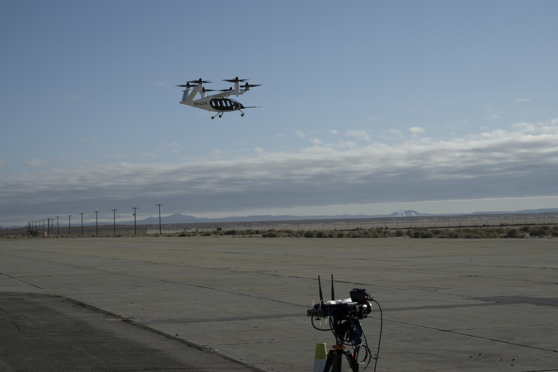
The top of a black tripod with black testing instruments stands in the foreground on a concrete pad with a desert landscape and power lines in the background. A black and white aircraft is in the sky above in the background with blue sky and clouds behind as the aircraft hovers. The aircraft has six black propellors that sit on white arms and connect to the aircraft body, which has black doors and is pod-shaped. The aircraft sits on three small wheels.
One of multiple NASA distributed sensing ground nodes is set up in the foreground while an experimental air taxi aircraft owned by Joby Aviation hovers in the background near NASA’s Armstrong Flight Research Center in Edwards, California, on March 12, 2025. NASA is collecting information during this study to help advance future air taxi flights, especially those occurring in cities, to track aircraft moving through traffic corridors and around landing zones.
NASA/Genaro Vavuris

This technology will be important for future air taxi flights, especially those occurring in cities by tracking aircraft moving through traffic corridors and around landing zones. Distributed sensing has the potential to enhance collision avoidance systems, air traffic management, ground-based landing sensors, and more.

“Our early work on a distributed network of sensors, and through this study, gives us the opportunity to test new technologies that can someday assist in airspace monitoring and collision avoidance above cities,” said George Gorospe, lead for this effort from NASA’s Ames Research Center in California’s Silicon Valley.

Using this data from an experimental air taxi aircraft, NASA will further develop the technology needed to help create safer air taxi flights in high-traffic areas. Both of these efforts will benefit the companies working to bring air taxis and drones safely into the airspace.

The work is led by NASA’s Transformational Tools and Technologies and Convergent Aeronautics Solutions projects under the Transformative Aeronautics Concepts program in support of NASA’s Advanced Air Mobility mission. NASA’s Advanced Air Mobility mission seeks to deliver data to guide the industry’s development of electric air taxis and drones.

link

Q. What is NASA studying with its Joby Aircraft test?
A. NASA is studying wind effects and aircraft tracking with its Joby Aircraft test to help advance future air taxi flights, especially those occurring in cities.

Q. Why is NASA collecting data from an experimental air taxi aircraft?
A. NASA is collecting data to improve tools for collision avoidance and landing operations, as well as ensure safe and efficient air taxi operations in various weather conditions.

Q. What type of wind is being studied by NASA?
A. NASA is studying the rolling wind generated by the propellers of the Joby Aircraft, which can affect aircraft performance and others flying nearby.

Q. How will NASA use the data from its ground nodes?
A. NASA will use the data to demonstrate the tracking capabilities and functions of its “distributed sensing” technology, which involves embedding multiple sensors in an area where aircraft are operating.

Q. What is distributed sensing technology?
A. Distributed sensing technology involves embedding multiple sensors in an area where aircraft are operating to track aircraft moving through traffic corridors and around landing zones.

Q. Why is NASA’s Advanced Air Mobility mission important?
A. NASA’s Advanced Air Mobility mission seeks to deliver data to guide the industry’s development of electric air taxis and drones, making air travel safer and more efficient.

Q. What type of aircraft is being tested by NASA?
A. The Joby Aviation demonstrator aircraft, which has six rotors that allow for vertical takeoffs and landings, and tilt to provide lift in flight.

Q. How will the data from this test benefit the companies working on air taxis and drones?
A. The data will help these companies develop safer air taxi flights in high-traffic areas, enhancing collision avoidance systems and air traffic management.

Q. What is the goal of NASA’s Transformational Tools and Technologies project?
A. The goal is to develop technologies that can assist in airspace monitoring and collision avoidance above cities, benefiting the industry as a whole.