News Warner Logo

News Warner

Testing in the Clouds: NASA Flies to Improve Satellite Data

Testing in the Clouds: NASA Flies to Improve Satellite Data

  • NASA’s ER-2 science aircraft flew instruments designed to improve satellite data products and Earth science observations in February 2025, as part of the GSFC Lidar Observation and Validation Experiment (GLOVE).
  • The GLOVE experiment aims to validate satellite data about cloud and airborne particles in the Earth’s atmosphere, using instruments installed on the ER-2 aircraft to measure and validate data from satellites orbiting the Earth.
  • The validation provided by GLOVE is crucial for ensuring the accuracy and reliability of satellite data, which will improve satellite information for applications like weather forecasting and hazard monitoring.
  • The ER-2 flew over various regions in Oregon, Arizona, Utah, Nevada, and California, collecting data on different types of clouds, including cirrus clouds, marine stratocumulus, rain, snow, and multiple cloud types.
  • The GLOVE experiment is a collaboration between NASA engineers, scientists, and aircraft professionals, with support from universities and research institutions, to improve satellite data products for Earth science applications.

3 min read

Preparations for Next Moonwalk Simulations Underway (and Underwater)
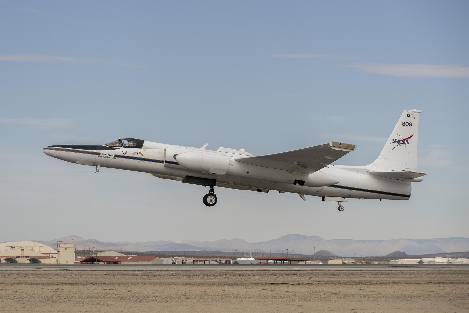
A plane begins to ascend from the runway on dim desert morning, heading toward the left of the frame. The wheels of the plane are still dropped and the nose of the plane is pointed upward toward higher skies, its tail featuring the NASA insignia. The helmeted pilot inside is barely visible through the cockpit window. Below a desert landscape with indiscernible buildings are flanked by a hazy mountain range in the distance.
Piloted by NASA’s Tim Williams, the ER-2 science aircraft ascends for one of the final science flights for the GSFC Lidar Observation and Validation Experiment (GLOVE) on Feb. 1, 2025. As a collaboration between engineers, scientists, and aircraft professionals, GLOVE aims to improve satellite data products for Earth Science applications.
NASA/Steve Freeman

In February, NASA’s ER-2 science aircraft flew instruments designed to improve satellite data products and Earth science observations. From data collection to processing, satellite systems continue to advance, and NASA is exploring how instruments analyzing clouds can improve data measurement methods.

Researchers participating in the Goddard Space Flight Center Lidar Observation and Validation Experiment (GLOVE) used the ER-2 – based at NASA’s Armstrong Flight Research Center in Edwards, California – to validate satellite data about cloud and airborne particles in the Earth’s atmosphere. Scientists are using GLOVE instruments installed onboard the aircraft to measure and validate data about clouds generated by satellite sensors already orbiting in space around Earth.

“The GLOVE data will allow us to test new artificial intelligence algorithms in data processing,” said John Yorks, principal investigator for GLOVE and research physical scientist at NASA’s Goddard Space Flight Center in Greenbelt, Maryland. “These algorithms aim to improve the cloud and aerosol detection in data produced by the satellites.”
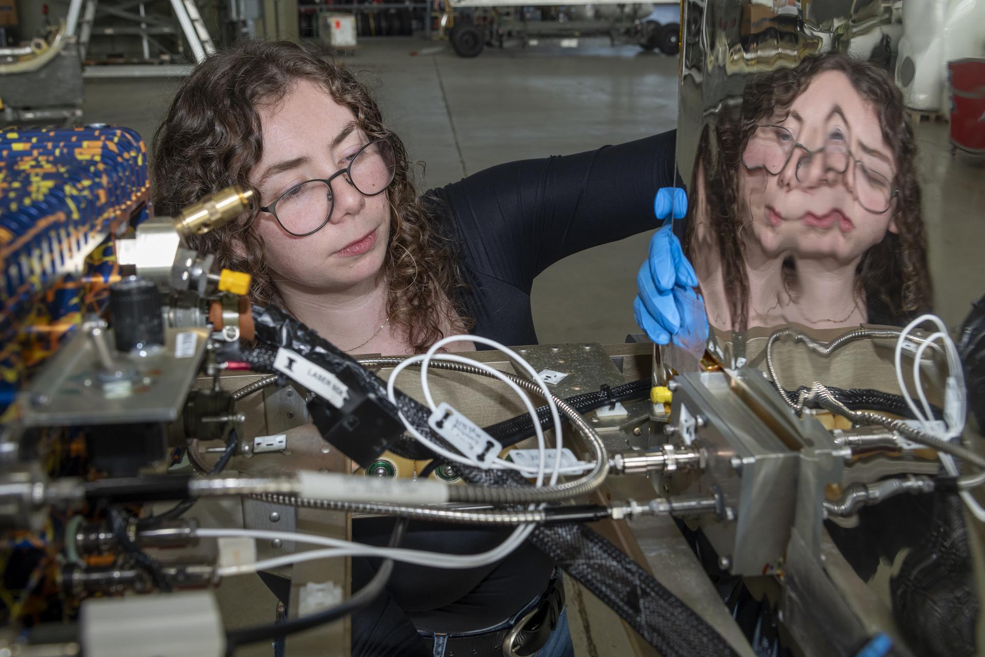
A woman face peers between two frames of a scientific instrument. The instrument is riddled with cables and cords and she manipulates some unseen component with blue rubber gloves. The right part of the instrument has a beveled reflective surface parallel to her face, and her reflection is distorted on the exposed metallic surface.
Jennifer Moore, a researcher from NASA’s Goddard Space Flight Center, checks the cabling on the Roscoe instrument at NASA’s Armstrong Flight Research Center in Edwards, California, for the GSFC Lidar Observation and Validation Experiment (GLOVE) on Feb. 1, 2025. The Roscoe instrument will be uploaded onto NASA’s ER-2 science aircraft.
NASA/Steve Freeman

The validation provided by GLOVE is crucial because it ensures the accuracy and reliability of satellite data. “The instruments on the plane provide a higher resolution measurement ‘truth’ to ensure the data is a true representation of the atmospheric scene being sampled,” Yorks said.

The ER-2 flew over various parts of Oregon, Arizona, Utah, and Nevada, as well as over the Pacific Ocean off the coast of California. These regions reflected various types of atmospheres, including cirrus clouds, marine stratocumulus, rain and snow, and areas with multiple types of clouds.

“The goal is to improve satellite data products for Earth science applications,” Yorks said. “These measurements allow scientists and decision-makers to confidently use this satellite information for applications like weather forecasting and hazard monitoring.”

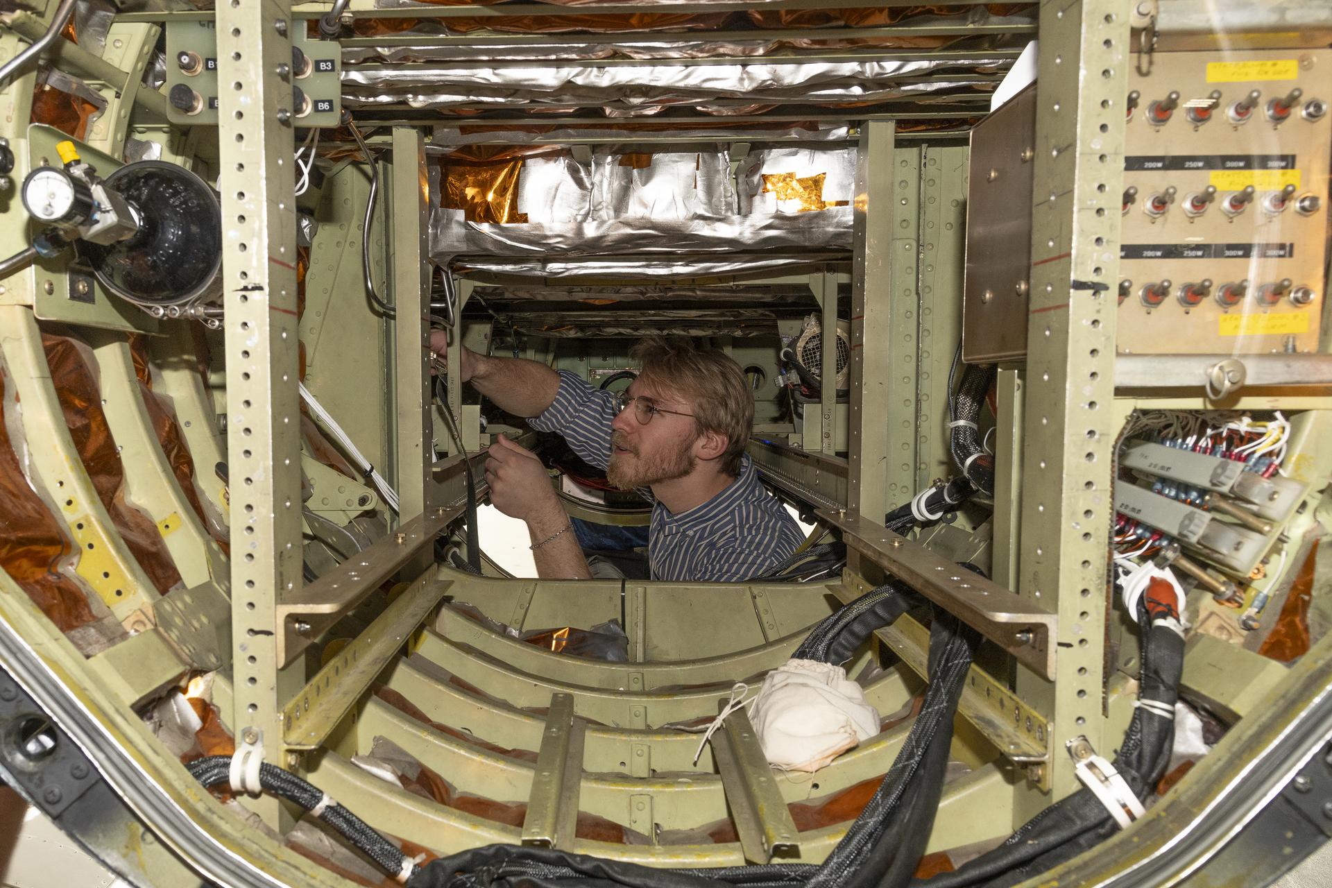
A man’s torso pokes up through the floorboard of a cylindrical aircraft pod. He manipulates an unseen component of the inside paneling of the pod, installed with an intricate network of cables, cords, and switches. He has blonde hair and a beard, and wears glasses with a striped shirt.
Researcher Jackson Begolka from the University of Iowa examines instrument connectors onboard the ER-2 aircraft at NASA’s Armstrong Flight Research Center in Edwards, California, on Feb. 1, 2025. The GLOVE instrument will validate data from satellites orbiting the Earth.
NASA/Steve Freeman

The four instruments installed on the ER-2 were the Cloud Physics Lidar, the Roscoe Lidar, the enhanced Moderate Resolution Imaging Spectroradiometer Airborne Simulator, and the Cloud Radar System. These instruments validate data produced by sensors on NASA’s Ice, Cloud, and Land Elevation Satellite 2 (ICESat-2) and the Earth Cloud, Aerosol and Radiation Explorer (EarthCARE), a joint venture between the ESA (European Space Agency) and JAXA (Japan Aerospace Exploration Agency).

“Additionally, the EarthCARE satellite is flying the first ever Doppler radar for measurements of air motions within clouds,” Yorks said. While the ER-2 is operated by pilots and aircrew from NASA Armstrong, these instruments are supported by scientists from NASA Goddard, NASA’s Ames Research Center in California’s Silicon Valley, and the Naval Research Laboratory office in Monterey, California, as well as by students from the University of Iowa in Iowa City and the University of Maryland College Park.

link

Q. What is NASA’s ER-2 science aircraft used for?
A. The ER-2 is a research aircraft that was flown by NASA to validate satellite data about clouds and airborne particles in the Earth’s atmosphere as part of the GSFC Lidar Observation and Validation Experiment (GLOVE).

Q. Who is the principal investigator for GLOVE?
A. John Yorks, a research physical scientist at NASA’s Goddard Space Flight Center, is the principal investigator for GLOVE.

Q. What are the four instruments installed on the ER-2 aircraft that were used in GLOVE?
A. The four instruments installed on the ER-2 were the Cloud Physics Lidar, the Roscoe Lidar, the enhanced Moderate Resolution Imaging Spectroradiometer Airborne Simulator, and the Cloud Radar System.

Q. What is the goal of the GLOVE experiment?
A. The goal of GLOVE is to improve satellite data products for Earth science applications, such as weather forecasting and hazard monitoring.

Q. How many regions did the ER-2 fly over during its final science flight?
A. The ER-2 flew over various parts of Oregon, Arizona, Utah, Nevada, and the Pacific Ocean off the coast of California.

Q. What is the significance of the validation provided by GLOVE?
A. The validation provided by GLOVE ensures the accuracy and reliability of satellite data, providing a higher resolution measurement ‘truth’ to ensure that the data is a true representation of the atmospheric scene being sampled.

Q. Who supports the instruments used in GLOVE?
A. Scientists from NASA Goddard, NASA’s Ames Research Center, the Naval Research Laboratory office, students from the University of Iowa and the University of Maryland College Park also support the instruments used in GLOVE.

Q. What is the purpose of the EarthCARE satellite?
A. The EarthCARE satellite is a joint venture between the ESA (European Space Agency) and JAXA (Japan Aerospace Exploration Agency), which includes flying the first ever Doppler radar for measurements of air motions within clouds.

Q. Why are scientists using GLOVE instruments to validate satellite data?
A. Scientists use GLOVE instruments to validate satellite data because they provide a higher resolution measurement ‘truth’ to ensure that the data is accurate and reliable, allowing scientists and decision-makers to confidently use this satellite information for applications like weather forecasting and hazard monitoring.